「地形」の編集履歴(バックアップ)一覧はこちら
地形 - (2016/10/16 (日) 23:18:42) の最新版との変更点
追加された行は緑色になります。
削除された行は赤色になります。
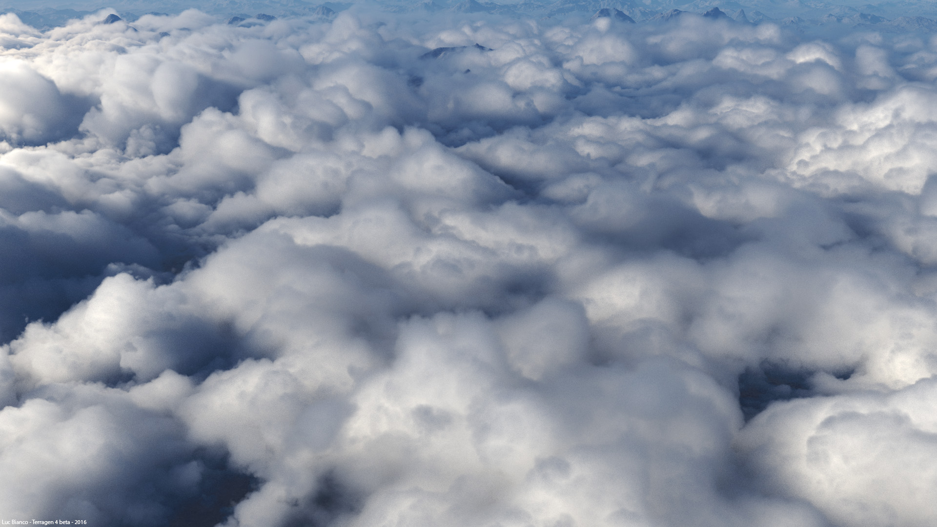
#image(terrain01.jpg)
Terragen allows you to create and manipulate highly realistic terrains, both heightfield and procedural. You can load existing heightfields to replicate real-world terrains and gain additional control by using a 3rd party terrain editor, or leverage the powerful built-in procedural functions to achieve global-scale terrains of nearly infinite detail, from the smallest pebble, to the largest mountains. You can combine the benefits of both terrain types in one scene, seamlessly. Even your heightfield terrains can be enhanced with the power and flexibility of procedurals.
Using 3D procedural functions, go beyond the limits of heightfields to create truly realistic terrains, including sheer cliffs and even overhangs. Let your imagination run wild and create out-of-this-world terrains.
|&image(st-helens-anim_final.jpg,width=380,height=214)|&bold(){&font(15){Georeferencing}}&br()Georeferencing of digital elevation data is a snap. This works automatically with a variety of raster GIS data, including most DEM and aerial imagery formats available from the USGS. Lat-long values can be entered manually if automatic georeferencing is unavailable or needs to be adjusted. Fractal details can be added automatically to imported elevation data.|
*Georeferencing
Georeferencing of digital elevation data is a snap. This works automatically with a variety of raster GIS data, including most DEM and aerial imagery formats available from the USGS. Lat-long values can be entered manually if automatic georeferencing is unavailable or needs to be adjusted. Fractal details can be added automatically to imported elevation data.
#image(terrain01.jpg)
Terragenはハイトフィールドとプロシージャル(手続き型処理)の両方を、非常にリアルな地形を作り出し、操る事が出来ます。あなたは現実世界の地形を再現し、サードパーティの地形エディタを使ってさらに手を加えられた既存のハイトフィールドを読込む、あるいは、ほぼ無限のディテール(最も小さい小石から最も大きい山まで)を持つ惑星規模の地形を達成するために、強力な内蔵されたプロシージャル関数を活用する事も出来ます。双方の地形タイプの利点を1シーンの中に継ぎ目無く結合させる事が出来ます。あなたが作るハイトフィールドの地形でさえも、プロシージャルの能力と柔軟性によって向上させる事が出来ます。
是非、3Dのプロシージャル機能を駆使して断崖絶壁やオーバーハングでさえも、本当にリアルな地形を作り出すためにハイトフィールドの限界を超えてみて下さい。あなたの想像力の箍を外して、この世のものならぬ地形を作成して下さい。
|&image(st-helens-anim_final.jpg,width=380,height=214)|&bold(){&font(15){ジオリファレンス}}&br()&br()デジタル標高データのジオリファレンスはとても簡単です。これは、USGS(National MapのSeamless Server)で入手可能な優れたDEMと航空画像フォーマットを含む、様々なラスタGISデータによって自動で生成されたものです。自動でジオリファレンスが得られない、または調整する必要がある場合は、Lat-long(Latitude/Longitude=緯度経度情報)値を手動で入力する事が出来ます。フラクタルのディテールはインポートされた標高データに自動で追加が可能です。|

 script?guid=on